Richard Seaman.
Hurricanes are powerful Atlantic storms which cause severe damage and change to the entire coastline. Hurricanes are driven by warm summer oceans and atmospheric convection, and can have a lifetime of up to a week. However, they often only last up to a few hours over any single area. They are well-known to the public as their intensity often causes billions of dollars worth of damage to people and the environment. Nor’easters, the often less publicized Atlantic coastal storm type, can have a similar if not stronger impact than hurricanes. This is because they are often larger than hurricanes and last longer over any given area. typical hurricane season is from May to November whereas the typical Nor’easter season is from December to April.

The tropics are a region of the Earth extending from about 23°N to 23°S, encompassing the Equator. This region of the planet receives the most sunlight on an annual basis, and as such, is subject to higher temperatures in both the air and the sea. These warm waters help to develop large and powerful thunderstorms at a rate directly proportional to the water temperature.

Thus, with higher sea surface temperatures during the summer months, with a maximum around 80°F, more thunder-storms form. With certain atmospheric disturbances, these thunderstorms can agglomerate into a single rotating mass called a tropical cyclone. As this cell strengthens due to the warm ocean waters, the cyclone can grow and increase in intensity by lowering its central pressure and increasing wind speeds.

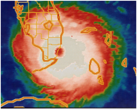
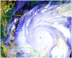
These cells have their distinctive westward, counterclockwise rotating motion due to general atmospheric wind patterns in the tropics and the Coriolis force. Once winds hit 64 mph, the tropical cyclone is classified as a hurricane and is given a predetermined name for that season. Typically hurricanes are characterized by multiple rain bands rotating around an intense band called the eye wall. Inside of this circle is a region of relatively calm winds called the eye.

Hurricanes go by various names such as a typhoon in the North Pacific Ocean and a cyclone in the South Pacific. Often, Atlantic based hurricanes form in an area aptly named the Main Development Region which is located roughly from West Africa to the Eastern Caribbean Sea. Typically, Atlantic Hurricane season spans from June 1st to November 30th.

This is because the waters of the Caribbean reach 80°F relatively early in the summer and as time progresses the warm waters stretch out further into the Atlantic basin. However, hurricanes, and especially tropical cyclones, are not limited to this time frame as evidenced by numerous December tropical storms.

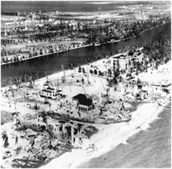
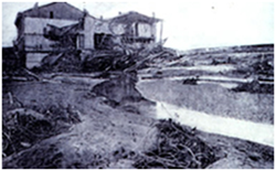
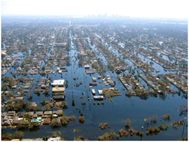
Hurricanes have winds that vary from 74 mph to greater than 140 mph and central pressures that can dip below 900mb (standard sea-level pressure is around 1013mb). These can induce sea waves up to, but not limited to, 24 feet. These, along with the winds, cause massive damage and large inland flooding. However, once over land the storms lose their source of fuel and dissipate quickly.
The Saffir-Simpson Scale
The Saffir-Simpson hurricane intensity scale was developed in the 1970’s by Herbert Saffir and Robert Simpson (Williams, 2005). It breaks hurricanes into 5 categories, grouped by the maximum sustained wind speeds, which are the peak winds over a period of 1 minute at a height of 10 meters above the surface. From these measured speeds, theoretical ranges for minimum central pressures and storm surges are calculated.

For more information visit the Saffir-Simpson Hurricane Scale webpage at the National Hurricane Center’s website (http://www.nhc.noaa.gov/aboutsshs.shtml)